 vesseltracker.com
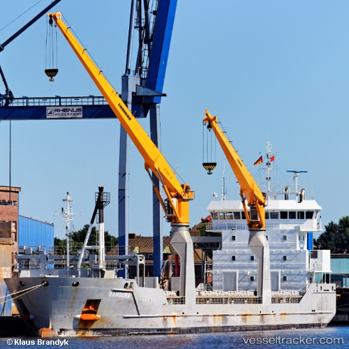
 Bandura
Current Status
Where is the vessel?
Bandura is currently in 33 nm W of Bear River City, based on AIS data received about 1h ago.
Latest AIS update:
Current position: 41.63504° N, 12.17866° W (33 nm W of Bear River City)
Average speed (last 7 days): Loading…
Average speed (last 30 days): Loading…
Vessel profile: Bandura is a Multi Purpose Carrier with dimensions 118m x 16m.
This page combines live AIS, route history, probable destination signals, nearby traffic, and port activity for practical vessel monitoring.
The current position of vessel Bandura is 41.63504 lat / -12.17866 lng. Updated: 2026-04-04 22:52:02 UTCNearest reference points:
- 25 nm S of Bear River City
- 20 nm SE of Bear River City
- 43 nm NW of Utiel
Currently sailing under the flag of Netherlands ![]()
Bandura built in 2010 year
Deadweight:
8217 tDetails:
Live Vessel Bandura Analytics (details, animations, etc.)
Recent AIS points (UTC):
2026-04-04 16:28:15 UTC · 42.75093, -11.24807 · SOG 11.9 kn · COG 210°2026-04-04 17:18:24 UTC · 42.60500, -11.36500 · SOG 11 kn · COG -1°
2026-04-04 21:33:02 UTC · 41.87462, -11.99242 · SOG 12.4 kn · COG 209°
2026-04-04 22:52:02 UTC · 41.63504, -12.17866 · SOG 12.5 kn · COG 209°