 vesseltracker.com
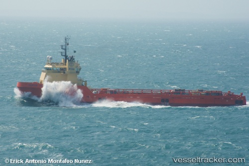
Santos Solution
Current StatusWhere is the vessel?
Santos Solution is currently in 14 nm E of Fluminense FPSO, based on AIS data received about 1h ago.
Latest AIS update:
Current position: 22.64333° S, 40.16000° W (14 nm E of Fluminense FPSO)
Average speed (last 7 days): Loading…
Average speed (last 30 days): Loading…
Vessel profile: Santos Solution is a Offshore Tug Supply Ship with dimensions 18m x 84m.
This page combines live AIS, route history, probable destination signals, nearby traffic, and port activity for practical vessel monitoring.
The current position of vessel Santos Solution is -22.64333 lat / -40.16000 lng. Updated: 2026-04-22 10:49:46 UTCNearest reference points:
- Near Fluminense FPSO
- Near PORTO DO ACU
- 24 nm SE of Carapebus
Details:
Live Vessel Santos Solution Analytics (details, animations, etc.)
Recent AIS points (UTC):
2026-04-22 07:31:45 UTC · -22.98833, -39.83500 · SOG 8 kn · COG -1°2026-04-22 07:55:00 UTC · -22.94956, -39.87373 · SOG 8.3 kn · COG 319°
2026-04-22 09:42:22 UTC · -22.76090, -40.04924 · SOG 8.1 kn · COG 319°
2026-04-22 10:49:46 UTC · -22.64333, -40.16000 · SOG 8 kn · COG -1°