 vesseltracker.com
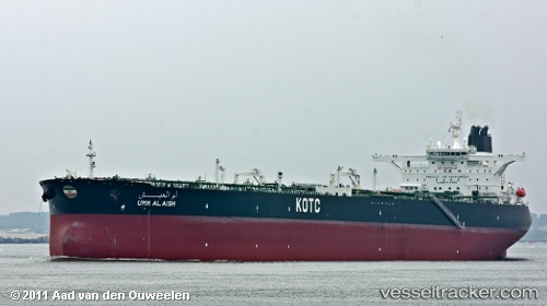
 Umm Al Aish
Current Status
Where is the vessel?
Umm Al Aish is currently in 14 nm SE of Shinas, based on AIS data received about 2d ago.
Latest AIS update:
Current position: 24.60589° N, 56.68102° E (14 nm SE of Shinas)
Average speed (last 7 days): Loading…
Average speed (last 30 days): Loading…
Vessel profile: Umm Al Aish is a Crude Oil Tanker with dimensions 333m x 333m.
This page combines live AIS, route history, probable destination signals, nearby traffic, and port activity for practical vessel monitoring.
The current position of vessel Umm Al Aish is 24.60589 lat / 56.68102 lng. Updated: 2026-04-03 13:22:54 UTCNearest reference points:
- 18 nm SE of SHINAS
- 17 nm SE of Shinas
- Near Fujairah
Currently sailing under the flag of Kuwait ![]()
Umm Al Aish built in 2011 year
Deadweight:
319634 tDetails:
Live Vessel Umm Al Aish Analytics (details, animations, etc.)
Recent AIS points (UTC):
2026-04-03 13:22:54 UTC · 24.60589, 56.68102 · SOG 0 kn · COG -1°2026-04-03 13:22:54 UTC · 24.60589, 56.68102 · SOG 0 kn · COG -1°
2026-04-03 13:22:54 UTC · 24.60589, 56.68102 · SOG 0 kn · COG -1°
2026-04-03 13:22:54 UTC · 24.60589, 56.68102 · SOG 0 kn · COG -1°