 vesseltracker.com
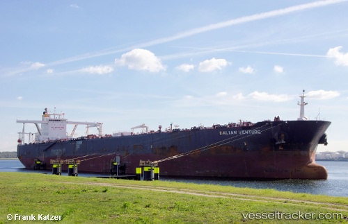
 Blue Nova
Current Status
Where is the vessel?
Blue Nova is currently in 16 nm W of de Ruyter, based on AIS data received about 2h ago.
Latest AIS update:
Current position: 52.21691° N, 3.64596° E (16 nm W of de Ruyter)
Average speed (last 7 days): Loading…
Average speed (last 30 days): Loading…
Vessel profile: Blue Nova is a Crude Oil Tanker with dimensions 330m x 330m.
This page combines live AIS, route history, probable destination signals, nearby traffic, and port activity for practical vessel monitoring.
The current position of vessel Blue Nova is 52.21691 lat / 3.64596 lng. Updated: 2026-03-26 13:52:07 UTCNearest reference points:
- 12 nm NE of Hunsdon
- Near Haarlemmermeer
- Near de Ruyter
Currently sailing under the flag of Liberia ![]()
Details:
Live Vessel Blue Nova Analytics (details, animations, etc.)
Recent AIS points (UTC):
2026-03-26 07:20:22 UTC · 52.21788, 3.64813 · SOG 0.4 kn · COG -1°2026-03-26 09:33:29 UTC · 52.21745, 3.64763 · SOG 0.9 kn · COG 321°
2026-03-26 12:21:30 UTC · 52.21683, 3.64617 · SOG 0.2 kn · COG 348°
2026-03-26 13:52:07 UTC · 52.21691, 3.64596 · SOG 0.5 kn · COG -1°