 vesseltracker.com
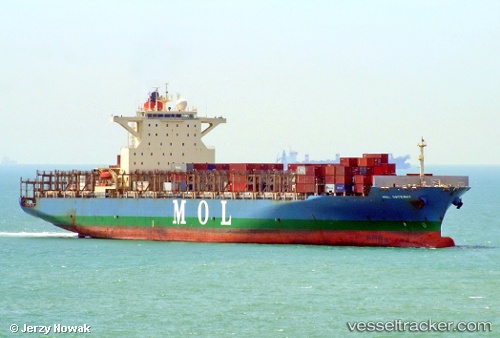
 Mol Gateway
Current Status
Where is the vessel?
Mol Gateway is currently in 23 nm NE of Ras Tannurah, based on AIS data received less than 1h ago.
Latest AIS update:
Current position: 26.84013° N, 50.53194° E (23 nm NE of Ras Tannurah)
Average speed (last 7 days): Loading…
Average speed (last 30 days): Loading…
Vessel profile: Mol Gateway is a Container Ship with dimensions 275m x 40m.
This page combines live AIS, route history, probable destination signals, nearby traffic, and port activity for practical vessel monitoring.
The current position of vessel Mol Gateway is 26.84013 lat / 50.53194 lng. Updated: 2026-03-29 15:57:18 UTCNearest reference points:
- Near Ad Dammam
- Near DAMMAM
- Near Qalali
Currently sailing under the flag of Portugal ![]()
Mol Gateway built in 2011 year
Deadweight:
71429 tDetails:
Live Vessel Mol Gateway Analytics (details, animations, etc.)
Recent AIS points (UTC):
2026-03-29 09:20:09 UTC · 26.83833, 50.53500 · SOG 0 kn · COG -1°2026-03-29 11:41:15 UTC · 26.83833, 50.53167 · SOG 0 kn · COG -1°
2026-03-29 14:04:27 UTC · 26.84063, 50.53164 · SOG 0.1 kn · COG 68°
2026-03-29 15:57:18 UTC · 26.84013, 50.53194 · SOG 1.6 kn · COG -1°