 vesseltracker.com
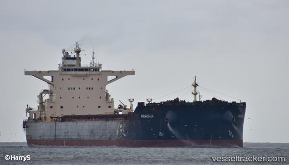
 GH ALIZE
Current Status
Where is the vessel?
GH ALIZE is currently in 37 nm S of Qisha Pt, based on AIS data received about 1h ago.
Latest AIS update:
Current position: 20.97333° N, 108.54667° E (37 nm S of Qisha Pt)
Average speed (last 7 days): Loading…
Average speed (last 30 days): Loading…
Vessel profile: GH ALIZE is a Bulk Carrier with dimensions m x m.
This page combines live AIS, route history, probable destination signals, nearby traffic, and port activity for practical vessel monitoring.
The current position of vessel GH ALIZE is 20.97333 lat / 108.54667 lng. Updated: 2026-04-12 19:07:33 UTCNearest reference points:
- 36 nm NW of Pei-Hai
- 26 nm SE of Qisha Pt
- 22 nm SE of Dongxing
Currently sailing under the flag of Bermuda ![]()
Details:
Live Vessel GH ALIZE Analytics (details, animations, etc.)
Recent AIS points (UTC):
2026-04-12 13:43:27 UTC · 21.53402, 108.36173 · SOG 0 kn · COG 359°2026-04-12 15:42:06 UTC · 21.53272, 108.35730 · SOG 3.1 kn · COG 196°
2026-04-12 18:04:56 UTC · 21.17961, 108.49035 · SOG 11.4 kn · COG 176°
2026-04-12 19:07:33 UTC · 20.97333, 108.54667 · SOG 12 kn · COG -1°