 vesseltracker.com
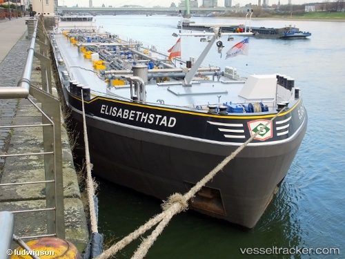
 Elisabethstad
Current Status
Where is the vessel?
Elisabethstad is currently in Near NUMANSDORP, based on AIS data received less than 1h ago.
Latest AIS update:
Current position: 51.69831° N, 4.42156° E (Near NUMANSDORP)
Average speed (last 7 days): Loading…
Average speed (last 30 days): Loading…
Vessel profile: Elisabethstad is a Chemical Oil Products Tanker with dimensions 135m x 15m.
This page combines live AIS, route history, probable destination signals, nearby traffic, and port activity for practical vessel monitoring.
The current position of vessel Elisabethstad is 51.69831 lat / 4.42156 lng. Updated: 2026-04-20 05:59:42 UTCNearest reference points:
- Near Cromstrijen
- Near DINTELMOND
- Near Zuid-Beijerland
Currently sailing under the flag of Belgium ![]()
Details:
Live Vessel Elisabethstad Analytics (details, animations, etc.)
Recent AIS points (UTC):
2026-04-20 02:21:57 UTC · 51.66072, 4.14988 · SOG 4.7 kn · COG -1°2026-04-20 03:44:45 UTC · 51.65383, 4.30646 · SOG 8.8 kn · COG -1°
2026-04-20 04:35:00 UTC · 51.68676, 4.40180 · SOG 0 kn · COG -1°
2026-04-20 05:59:42 UTC · 51.69831, 4.42156 · SOG 0 kn · COG -1°