 vesseltracker.com
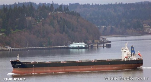
Gleamstar
Current StatusWhere is the vessel?
Gleamstar is currently in 76 nm E of Ruby, based on AIS data received less than 1h ago.
Latest AIS update:
Current position: 10.54500° N, 109.77667° E (76 nm E of Ruby)
Average speed (last 7 days): Loading…
Average speed (last 30 days): Loading…
Vessel profile: Gleamstar is a Bulk Carrier with dimensions 32m x 225m.
This page combines live AIS, route history, probable destination signals, nearby traffic, and port activity for practical vessel monitoring.
The current position of vessel Gleamstar is 10.54500 lat / 109.77667 lng. Updated: 2026-04-21 11:52:41 UTCNearest reference points:
- Near Rang Dong
- Near Vinh Cam Ranh
- 156 nm SE of Phan Rang-Tháp Chàm
Details:
Live Vessel Gleamstar Analytics (details, animations, etc.)
Recent AIS points (UTC):
2026-04-21 07:58:43 UTC · 9.81167, 109.55833 · SOG 11 kn · COG -1°2026-04-21 09:52:42 UTC · 10.16667, 109.66500 · SOG 11 kn · COG -1°
2026-04-21 09:52:42 UTC · 10.16667, 109.66500 · SOG 11 kn · COG -1°
2026-04-21 11:52:41 UTC · 10.54500, 109.77667 · SOG 11 kn · COG -1°