 vesseltracker.com
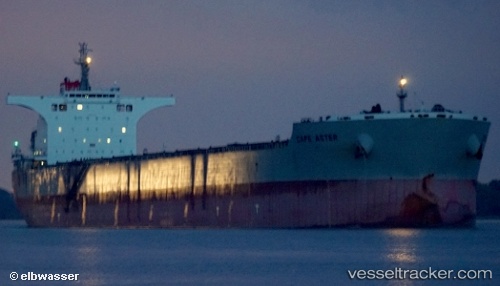
Cape Aster
Current StatusWhere is the vessel?
Cape Aster is currently in Open sea, approx. 496 nm off the nearest listed port, based on AIS data received about 10h ago.
Latest AIS update:
Current position: 4.98939° S, 6.62267° W (Open sea, approx. 496 nm off the nearest listed port)
Average speed (last 7 days): Loading…
Average speed (last 30 days): Loading…
Vessel profile: Cape Aster is a Bulk Carrier with dimensions 45m x 292m.
This page combines live AIS, route history, probable destination signals, nearby traffic, and port activity for practical vessel monitoring.
The current position of vessel Cape Aster is -4.98939 lat / -6.62267 lng. Updated: 2026-04-10 07:31:09 UTCNearest reference points:
- Open sea, approx. 496 nm off the nearest listed port
- Open sea, approx. 497 nm off the nearest listed port
- Open sea, approx. 493 nm off the nearest listed port
Details:
Live Vessel Cape Aster Analytics (details, animations, etc.)
Recent AIS points (UTC):
2026-04-10 02:36:09 UTC · -4.26198, -7.12486 · SOG 10.8 kn · COG 146°2026-04-10 04:17:30 UTC · -4.51833, -6.95667 · SOG 10 kn · COG -1°
2026-04-10 05:20:31 UTC · -4.67167, -6.84833 · SOG 10 kn · COG -1°
2026-04-10 07:31:09 UTC · -4.98939, -6.62267 · SOG 10.7 kn · COG 144°