 vesseltracker.com
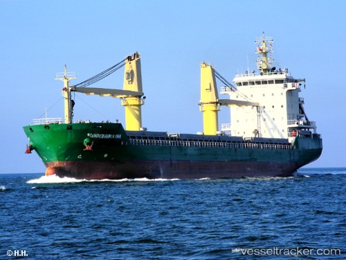
 CANGA STAR
Current Status
Where is the vessel?
CANGA STAR is currently in Near SOUVALA, based on AIS data received about 2h ago.
Latest AIS update:
Current position: 37.84188° N, 23.45982° E (Near SOUVALA)
Average speed (last 7 days): Loading…
Average speed (last 30 days): Loading…
Vessel profile: CANGA STAR is a Bulk Carrier with dimensions m x m.
This page combines live AIS, route history, probable destination signals, nearby traffic, and port activity for practical vessel monitoring.
The current position of vessel CANGA STAR is 37.84188 lat / 23.45982 lng. Updated: 2026-04-19 19:06:27 UTCNearest reference points:
- Near AEGINA BOATYARD
- Near PERDIKA
- Near PERAMA
Currently sailing under the flag of San Marino ![]()
Details:
Live Vessel CANGA STAR Analytics (details, animations, etc.)
Recent AIS points (UTC):
2026-04-19 16:03:57 UTC · 37.91505, 23.05682 · SOG 0 kn · COG 357°2026-04-19 16:05:17 UTC · 37.91505, 23.05681 · SOG 0 kn · COG 357°
2026-04-19 17:35:59 UTC · 37.88353, 23.19644 · SOG 8.3 kn · COG 99°
2026-04-19 19:06:27 UTC · 37.84188, 23.45982 · SOG 8.4 kn · COG 106°