 vesseltracker.com
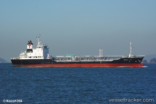
 Matsuyama Maru No.11
Current Status
Where is the vessel?
Matsuyama Maru No.11 is currently in Near SAKAI, based on AIS data received about 2h ago.
Latest AIS update:
Current position: 34.58475° N, 135.30920° E (Near SAKAI)
Average speed (last 7 days): Loading…
Average speed (last 30 days): Loading…
Vessel profile: Matsuyama Maru No.11 is a Oil Products Tanker with dimensions 104m x 16m.
This page combines live AIS, route history, probable destination signals, nearby traffic, and port activity for practical vessel monitoring.
The current position of vessel Matsuyama Maru No.11 is 34.58475 lat / 135.30920 lng. Updated: 2026-04-08 19:33:12 UTCNearest reference points:
- Near SAKAI
- Near Nada-Ku, Hyogo
- Near Kobe
Currently sailing under the flag of Japan ![]()
Details:
Live Vessel Matsuyama Maru No.11 Analytics (details, animations, etc.)
Recent AIS points (UTC):
2026-04-08 13:30:16 UTC · 34.58441, 135.31085 · SOG 0 kn · COG 329°2026-04-08 15:54:23 UTC · 34.58433, 135.30997 · SOG 0.1 kn · COG 20°
2026-04-08 17:57:13 UTC · 34.58487, 135.30927 · SOG 0 kn · COG 79°
2026-04-08 19:33:12 UTC · 34.58475, 135.30920 · SOG 0 kn · COG 68°