 vesseltracker.com
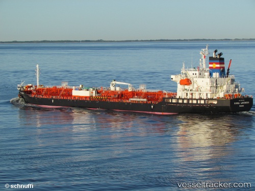
 Bunga Lavender
Current Status
Where is the vessel?
Bunga Lavender is currently in Near Lívingston, based on AIS data received less than 1h ago.
Latest AIS update:
Current position: 15.85987° N, 88.62782° W (Near Lívingston)
Average speed (last 7 days): Loading…
Average speed (last 30 days): Loading…
Vessel profile: Bunga Lavender is a Chemical Oil Products Tanker with dimensions 147m x 25m.
This page combines live AIS, route history, probable destination signals, nearby traffic, and port activity for practical vessel monitoring.
The current position of vessel Bunga Lavender is 15.85987 lat / -88.62782 lng. Updated: 2026-04-18 03:52:36 UTCNearest reference points:
- 14 nm NW of Puerto Cortes
- 12 nm SW of Dangriga
- 26 nm SE of Dangriga
Currently sailing under the flag of Panama ![]()
Bunga Lavender built in 2010 year
Deadweight:
19997 tDetails:
Live Vessel Bunga Lavender Analytics (details, animations, etc.)
Recent AIS points (UTC):
2026-04-17 21:57:17 UTC · 16.07995, -88.06585 · SOG 12.4 kn · COG 252°2026-04-18 00:05:18 UTC · 16.00922, -88.52775 · SOG 12.5 kn · COG 271°
2026-04-18 02:21:27 UTC · 15.85980, -88.62657 · SOG 0.2 kn · COG 73°
2026-04-18 03:52:36 UTC · 15.85987, -88.62782 · SOG 0 kn · COG 71°