 vesseltracker.com
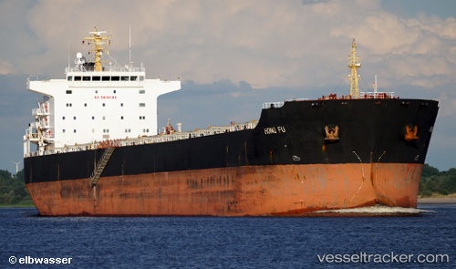
 Hong Fu
Current Status
Where is the vessel?
Hong Fu is currently in 72 nm W of Gageohyangri, based on AIS data received about 1h ago.
Latest AIS update:
Current position: 34.03167° N, 123.62667° E (72 nm W of Gageohyangri)
Average speed (last 7 days): Loading…
Average speed (last 30 days): Loading…
Vessel profile: Hong Fu is a Bulk Carrier with dimensions 225m x 225m.
This page combines live AIS, route history, probable destination signals, nearby traffic, and port activity for practical vessel monitoring.
The current position of vessel Hong Fu is 34.03167 lat / 123.62667 lng. Updated: 2026-04-02 03:59:55 UTCNearest reference points:
- 82 nm W of Gageohyangri
- 91 nm W of Gageohyangri
- 102 nm W of Gageohyangri
Currently sailing under the flag of Hong Kong ![]()
Hong Fu built in 2009 year
Deadweight:
76402 tDetails:
Live Vessel Hong Fu Analytics (details, animations, etc.)
Recent AIS points (UTC):
2026-04-01 21:50:06 UTC · 35.21903, 123.66384 · SOG 12.4 kn · COG 189°2026-04-02 00:11:35 UTC · 34.73237, 123.66137 · SOG 12.8 kn · COG -1°
2026-04-02 01:38:06 UTC · 34.44167, 123.67667 · SOG 12 kn · COG -1°
2026-04-02 03:59:55 UTC · 34.03167, 123.62667 · SOG 7 kn · COG -1°