 vesseltracker.com
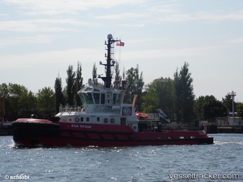
 BOA BRAGE
Current Status
Where is the vessel?
BOA BRAGE is currently in 16 nm N of Mudanya, based on AIS data received about 2h ago.
Latest AIS update:
Current position: 40.63457° N, 28.85466° E (16 nm N of Mudanya)
Average speed (last 7 days): Loading…
Average speed (last 30 days): Loading…
Vessel profile: BOA BRAGE is a Tug with dimensions m x m.
This page combines live AIS, route history, probable destination signals, nearby traffic, and port activity for practical vessel monitoring.
The current position of vessel BOA BRAGE is 40.63457 lat / 28.85466 lng. Updated: 2026-03-28 03:54:48 UTCNearest reference points:
- 17 nm S of Kumport
- 16 nm S of Kumport
- 14 nm SW of Maltepe
Currently sailing under the flag of Malta ![]()
Details:
Live Vessel BOA BRAGE Analytics (details, animations, etc.)
Recent AIS points (UTC):
2026-03-27 22:24:04 UTC · 40.76498, 29.53405 · SOG 0 kn · COG 349°2026-03-28 00:21:03 UTC · 40.76496, 29.53403 · SOG 0 kn · COG 350°
2026-03-28 01:25:46 UTC · 40.74545, 29.43562 · SOG 14.7 kn · COG 258°
2026-03-28 03:54:48 UTC · 40.63457, 28.85466 · SOG 11.6 kn · COG 227°