 vesseltracker.com
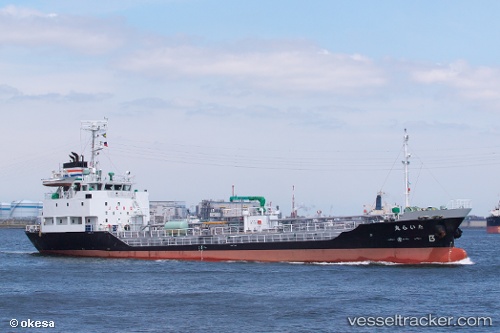
 Tairamaru
Current Status
Where is the vessel?
Tairamaru is currently in Near SAKAI, based on AIS data received about 1h ago.
Latest AIS update:
Current position: 34.52221° N, 135.40443° E (Near SAKAI)
Average speed (last 7 days): Loading…
Average speed (last 30 days): Loading…
Vessel profile: Tairamaru is a Bitumen Tanker with dimensions 69m x 11m.
This page combines live AIS, route history, probable destination signals, nearby traffic, and port activity for practical vessel monitoring.
The current position of vessel Tairamaru is 34.52221 lat / 135.40443 lng. Updated: 2026-04-16 23:47:56 UTCNearest reference points:
- Near SAKAI
- Near Nada-Ku, Hyogo
- Near Kobe
Currently sailing under the flag of Japan ![]()
Details:
Live Vessel Tairamaru Analytics (details, animations, etc.)
Recent AIS points (UTC):
2026-04-16 16:09:13 UTC · 34.54304, 135.35574 · SOG 0.1 kn · COG 43°2026-04-16 19:21:13 UTC · 34.54307, 135.35580 · SOG 0 kn · COG 45°
2026-04-16 21:32:07 UTC · 34.54167, 135.35500 · SOG 0 kn · COG -1°
2026-04-16 23:47:56 UTC · 34.52221, 135.40443 · SOG 5.1 kn · COG 174°