 vesseltracker.com
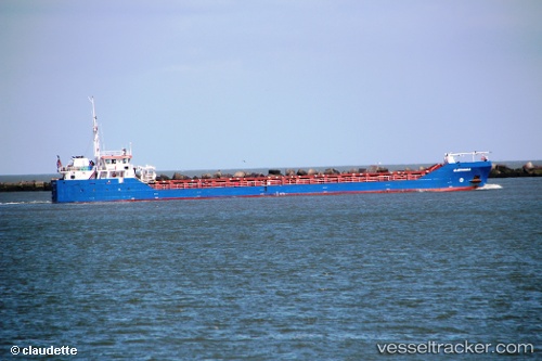
Vessel Catania IMO: 9556832, MMSI: 305930000 General Cargo Ship
UTC, 43.45969, -1.99816, course: 332, speed: 9
UTC, 43.74113, -2.19495, course: 331, speed: 8.8
2026-03-25 02:25:51 UTC, 44.08203, -2.43113, course: 333, speed: 8.7
Live Vessel Catania Analytics (details, animations, etc.)
Live AIS position: UTC. 42 nm NE of Getxo), updated 2026-03-25 02:25:51 UTC.Find the position of the vessel Catania on the map. The latter are known coordinates and path.
marine traffic ship tracker show on live map
The current position of vessel Catania is 44.08203 lat / -2.43113 lng. Updated: 2026-03-25 02:25:51 UTCCurrently sailing under the flag of Antigua Barbuda
Catania built in 2012 year
Deadweight:
2595 tDetails:
Last coordinates of the vessel:
UTC, 43.32297, -1.92357, course: 209, speed: 0UTC, 43.45969, -1.99816, course: 332, speed: 9
UTC, 43.74113, -2.19495, course: 331, speed: 8.8
2026-03-25 02:25:51 UTC, 44.08203, -2.43113, course: 333, speed: 8.7