 vesseltracker.com
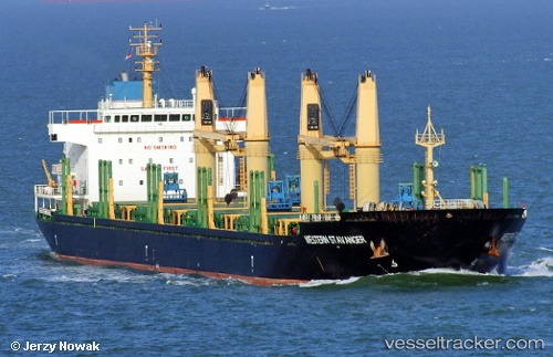
 AVRA 1
Current Status
Where is the vessel?
AVRA 1 is currently in 12 nm S of Conakry Eco, based on AIS data received less than 1h ago.
Latest AIS update:
Current position: 9.30500° N, 13.76333° W (12 nm S of Conakry Eco)
Average speed (last 7 days): Loading…
Average speed (last 30 days): Loading…
Vessel profile: AVRA 1 is a Bulk Carrier with dimensions m x m.
This page combines live AIS, route history, probable destination signals, nearby traffic, and port activity for practical vessel monitoring.
The current position of vessel AVRA 1 is 9.30500 lat / -13.76333 lng. Updated: 2026-04-16 23:34:47 UTCNearest reference points:
- Near Conakry
- 28 nm S of Conakry
- 49 nm S of Port de Boké
Currently sailing under the flag of Marshall Islands ![]()
Details:
Live Vessel AVRA 1 Analytics (details, animations, etc.)
Recent AIS points (UTC):
2026-04-16 15:40:23 UTC · 9.52192, -13.71270 · SOG 0 kn · COG 231°2026-04-16 19:29:41 UTC · 9.32342, -13.75206 · SOG 5.2 kn · COG 215°
2026-04-16 22:07:17 UTC · 9.30562, -13.76457 · SOG 0 kn · COG 26°
2026-04-16 23:34:47 UTC · 9.30500, -13.76333 · SOG 0 kn · COG -1°