 vesseltracker.com
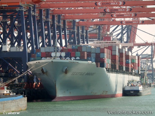
 Seattle Bridge
Current Status
Where is the vessel?
Seattle Bridge is currently in 53 nm E of Lü-hua Shan, based on AIS data received about 2h ago.
Latest AIS update:
Current position: 30.67026° N, 123.62620° E (53 nm E of Lü-hua Shan)
Average speed (last 7 days): Loading…
Average speed (last 30 days): Loading…
Vessel profile: Seattle Bridge is a Container Ship with dimensions 293m x 40m.
This page combines live AIS, route history, probable destination signals, nearby traffic, and port activity for practical vessel monitoring.
The current position of vessel Seattle Bridge is 30.67026 lat / 123.62620 lng. Updated: 2026-04-23 01:23:32 UTCNearest reference points:
- 56 nm E of Lü-hua Shan
- 49 nm E of Lü-hua Shan
- 46 nm SE of Lü-hua Shan
Currently sailing under the flag of Panama ![]()
Seattle Bridge built in 2010 year
Deadweight:
72890 tDetails:
Live Vessel Seattle Bridge Analytics (details, animations, etc.)
Recent AIS points (UTC):
2026-04-22 21:24:11 UTC · 31.34962, 124.08612 · SOG 12 kn · COG 249°2026-04-22 22:19:12 UTC · 31.24221, 123.91724 · SOG 11.9 kn · COG 233°
2026-04-22 23:34:02 UTC · 31.05697, 123.72021 · SOG 13.1 kn · COG -1°
2026-04-23 01:23:32 UTC · 30.67026, 123.62620 · SOG 12.6 kn · COG 192°