 vesseltracker.com
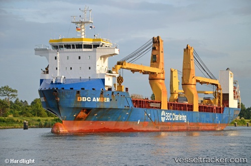
Bbc Amber
Current StatusWhere is the vessel?
Bbc Amber is currently in 46 nm S of Nayarit, based on AIS data received less than 1h ago.
Latest AIS update:
Current position: 20.88833° N, 106.57167° W (46 nm S of Nayarit)
Average speed (last 7 days): Loading…
Average speed (last 30 days): Loading…
Vessel profile: Bbc Amber is a Multi Purpose Carrier with dimensions 23m x 153m.
This page combines live AIS, route history, probable destination signals, nearby traffic, and port activity for practical vessel monitoring.
The current position of vessel Bbc Amber is 20.88833 lat / -106.57167 lng. Updated: 2026-04-05 23:25:07 UTCNearest reference points:
- 35 nm S of Nayarit
- Near NUEVO VALLARTA
- Near Mazatlan
Details:
Live Vessel Bbc Amber Analytics (details, animations, etc.)
Recent AIS points (UTC):
2026-04-05 17:14:14 UTC · 22.34440, -107.47531 · SOG 16.4 kn · COG 148°2026-04-05 18:04:49 UTC · 22.14368, -107.34883 · SOG 16.4 kn · COG 148°
2026-04-05 21:30:48 UTC · 21.33833, -106.85167 · SOG 16 kn · COG -1°
2026-04-05 23:25:07 UTC · 20.88833, -106.57167 · SOG 17 kn · COG -1°