 vesseltracker.com
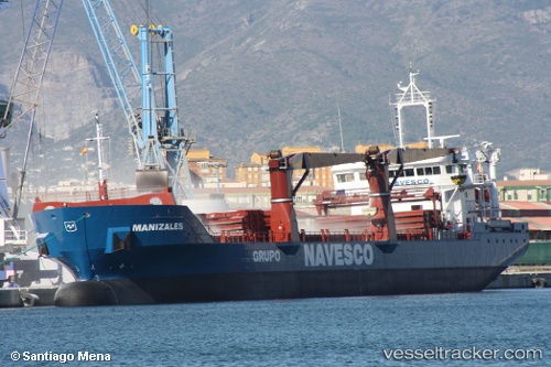
 Manizales
Current Status
Where is the vessel?
Manizales is currently in 71 nm N of Yucatan Channel, based on AIS data received less than 1h ago.
Latest AIS update:
Current position: 22.98167° N, 85.37333° W (71 nm N of Yucatan Channel)
Average speed (last 7 days): Loading…
Average speed (last 30 days): Loading…
Vessel profile: Manizales is a General Cargo Ship with dimensions 119m x 119m.
This page combines live AIS, route history, probable destination signals, nearby traffic, and port activity for practical vessel monitoring.
The current position of vessel Manizales is 22.98167 lat / -85.37333 lng. Updated: 2026-04-07 06:13:41 UTCNearest reference points:
- 58 nm S of San Julian
- Near Puerto Juárez
- 14 nm W of Florida Straits
Currently sailing under the flag of Panama ![]()
Manizales built in 2011 year
Deadweight:
7850 tDetails:
Live Vessel Manizales Analytics (details, animations, etc.)
Recent AIS points (UTC):
2026-04-06 23:49:41 UTC · 23.05167, -84.16167 · SOG 10 kn · COG -1°2026-04-07 01:40:40 UTC · 23.00333, -84.50667 · SOG 10 kn · COG -1°
2026-04-07 03:22:41 UTC · 22.98667, -84.82667 · SOG 10 kn · COG -1°
2026-04-07 06:13:41 UTC · 22.98167, -85.37333 · SOG 10 kn · COG -1°