 vesseltracker.com
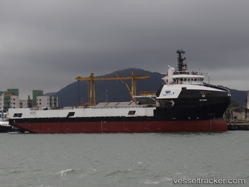
Batuira
Current StatusWhere is the vessel?
Batuira is currently in Near PORTO DO ACU, based on AIS data received about 1h ago.
Latest AIS update:
Current position: 21.86221° S, 41.01799° W (Near PORTO DO ACU)
Average speed (last 7 days): Loading…
Average speed (last 30 days): Loading…
Vessel profile: Batuira is a Offshore Tug Supply Ship with dimensions 16m x 88m.
This page combines live AIS, route history, probable destination signals, nearby traffic, and port activity for practical vessel monitoring.
The current position of vessel Batuira is -21.86221 lat / -41.01799 lng. Updated: 2026-04-17 19:30:27 UTCNearest reference points:
- Near PORTO DO ACU
- 24 nm SE of Carapebus
- Near Fluminense FPSO
Details:
Live Vessel Batuira Analytics (details, animations, etc.)
Recent AIS points (UTC):
2026-04-17 14:14:35 UTC · -21.86219, -41.01802 · SOG 0 kn · COG 60°2026-04-17 16:25:25 UTC · -21.86218, -41.01803 · SOG 0 kn · COG 59°
2026-04-17 17:35:13 UTC · -21.86219, -41.01802 · SOG 0 kn · COG 59°
2026-04-17 19:30:27 UTC · -21.86221, -41.01799 · SOG 0 kn · COG 60°