 vesseltracker.com
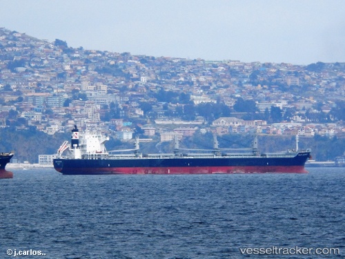
Mar Camino
Current StatusWhere is the vessel?
Mar Camino is currently in 299 nm W of Santa Rita, based on AIS data received less than 1h ago.
Latest AIS update:
Current position: 12.24534° N, 149.63052° W (299 nm W of Santa Rita)
Average speed (last 7 days): Loading…
Average speed (last 30 days): Loading…
Vessel profile: Mar Camino is a Bulk Oil Carrier with dimensions 30m x 189m.
This page combines live AIS, route history, probable destination signals, nearby traffic, and port activity for practical vessel monitoring.
The current position of vessel Mar Camino is 12.24534 lat / -149.63052 lng. Updated: 2026-03-31 23:55:43 UTCNearest reference points:
- Open sea, approx. 404 nm off the nearest listed port
- Open sea (no nearby ports in database)
- Open sea, approx. 412 nm off the nearest listed port
Details:
Live Vessel Mar Camino Analytics (details, animations, etc.)
Recent AIS points (UTC):
2026-03-31 18:13:20 UTC · 12.72667, -150.71667 · SOG 12 kn · COG -1°2026-03-31 19:21:05 UTC · 12.63045, -150.49986 · SOG 12 kn · COG 112°
2026-03-31 21:28:16 UTC · 12.45167, -150.09833 · SOG 12 kn · COG -1°
2026-03-31 23:55:43 UTC · 12.24534, -149.63052 · SOG 12 kn · COG 113°