 vesseltracker.com
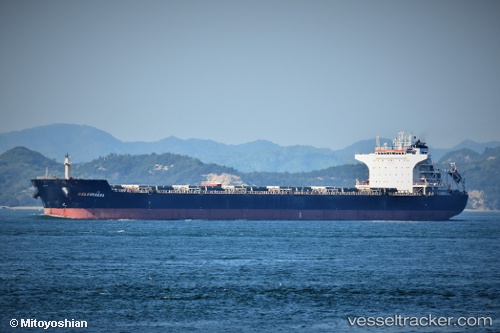
Sm Samarinda
Current StatusWhere is the vessel?
Sm Samarinda is currently in 24 nm NW of Sangwangdeungdo, based on AIS data received about 1h ago.
Latest AIS update:
Current position: 35.85568° N, 125.72083° E (24 nm NW of Sangwangdeungdo)
Average speed (last 7 days): Loading…
Average speed (last 30 days): Loading…
Vessel profile: Sm Samarinda is a Bulk Carrier with dimensions 38m x 229m.
This page combines live AIS, route history, probable destination signals, nearby traffic, and port activity for practical vessel monitoring.
The current position of vessel Sm Samarinda is 35.85568 lat / 125.72083 lng. Updated: 2026-04-19 09:46:41 UTCNearest reference points:
- 19 nm NW of Sangwangdeungdo
- 22 nm W of Biin
- Near WIDO
Details:
Live Vessel Sm Samarinda Analytics (details, animations, etc.)
Recent AIS points (UTC):
2026-04-19 05:59:33 UTC · 35.85833, 125.72500 · SOG 0 kn · COG -1°2026-04-19 07:44:43 UTC · 35.85833, 125.72333 · SOG 0 kn · COG -1°
2026-04-19 09:46:41 UTC · 35.85568, 125.72083 · SOG 0.1 kn · COG -1°
2026-04-19 09:46:41 UTC · 35.85568, 125.72083 · SOG 0.1 kn · COG -1°