 vesseltracker.com
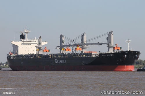
 Finch Arrow
Current Status
Where is the vessel?
Finch Arrow is currently in 64 nm S of Saint-Pierre, based on AIS data received less than 1h ago.
Latest AIS update:
Current position: 22.38583° S, 55.24498° E (64 nm S of Saint-Pierre)
Average speed (last 7 days): Loading…
Average speed (last 30 days): Loading…
Vessel profile: Finch Arrow is a General Cargo Ship with dimensions 210m x 36m.
This page combines live AIS, route history, probable destination signals, nearby traffic, and port activity for practical vessel monitoring.
The current position of vessel Finch Arrow is -22.38583 lat / 55.24498 lng. Updated: 2026-04-17 06:23:17 UTCNearest reference points:
- 129 nm W of Al Azaiba
- 61 nm NW of Al Azaiba
- Near Port Louis
Currently sailing under the flag of Panama ![]()
Finch Arrow built in 2013 year
Deadweight:
72914 tDetails:
Live Vessel Finch Arrow Analytics (details, animations, etc.)
Recent AIS points (UTC):
2026-04-17 00:23:58 UTC · -21.74234, 56.33700 · SOG 12.4 kn · COG 241°2026-04-17 01:40:38 UTC · -21.88357, 56.10166 · SOG 11.9 kn · COG 242°
2026-04-17 04:02:47 UTC · -22.14521, 55.66609 · SOG 11.8 kn · COG 240°
2026-04-17 06:23:17 UTC · -22.38583, 55.24498 · SOG 11.8 kn · COG 239°