 vesseltracker.com
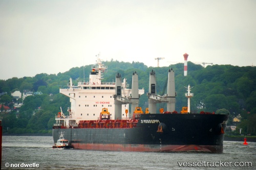
 STAR SOUTHPORT
Current Status
Where is the vessel?
STAR SOUTHPORT is currently in Near Binondo, based on AIS data received less than 1h ago.
Latest AIS update:
Current position: 14.59977° N, 120.94254° E (Near Binondo)
Average speed (last 7 days): Loading…
Average speed (last 30 days): Loading…
Vessel profile: STAR SOUTHPORT is a Bulk Carrier with dimensions m x m.
This page combines live AIS, route history, probable destination signals, nearby traffic, and port activity for practical vessel monitoring.
The current position of vessel STAR SOUTHPORT is 14.59977 lat / 120.94254 lng. Updated: 2026-03-31 05:44:29 UTCNearest reference points:
- Near Tondo
- Near Caloocan City
- Near Malabon
Currently sailing under the flag of Liberia ![]()
Details:
Live Vessel STAR SOUTHPORT Analytics (details, animations, etc.)
Recent AIS points (UTC):
2026-03-30 23:41:27 UTC · 14.59975, 120.94259 · SOG 0.1 kn · COG 341°2026-03-31 02:02:28 UTC · 14.59983, 120.94250 · SOG 0 kn · COG 343°
2026-03-31 04:08:27 UTC · 14.59977, 120.94256 · SOG 0 kn · COG 344°
2026-03-31 05:44:29 UTC · 14.59977, 120.94254 · SOG 0 kn · COG 344°