 vesseltracker.com
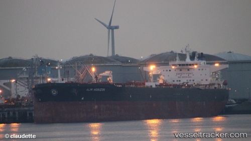
 Almi Horizon
Current Status
Where is the vessel?
Almi Horizon is currently in 20 nm W of Abu Zenimah, based on AIS data received about 1h ago.
Latest AIS update:
Current position: 29.15822° N, 32.72986° E (20 nm W of Abu Zenimah)
Average speed (last 7 days): Loading…
Average speed (last 30 days): Loading…
Vessel profile: Almi Horizon is a Crude Oil Tanker with dimensions 274m x 274m.
This page combines live AIS, route history, probable destination signals, nearby traffic, and port activity for practical vessel monitoring.
The current position of vessel Almi Horizon is 29.15822 lat / 32.72986 lng. Updated: 2026-04-20 21:42:46 UTCNearest reference points:
- Near Ras Sudr
- Near Al Adabiyah
- Near Bur Ibrahim
Currently sailing under the flag of Liberia ![]()
Almi Horizon built in 2011 year
Deadweight:
157787 tDetails:
Live Vessel Almi Horizon Analytics (details, animations, etc.)
Recent AIS points (UTC):
2026-04-20 17:27:36 UTC · 29.87873, 32.54956 · SOG 7.9 kn · COG 173°2026-04-20 19:12:12 UTC · 29.58255, 32.53350 · SOG 11.1 kn · COG -1°
2026-04-20 19:52:16 UTC · 29.46870, 32.58331 · SOG 10.8 kn · COG -1°
2026-04-20 21:42:46 UTC · 29.15822, 32.72986 · SOG 11.1 kn · COG 157°