 vesseltracker.com
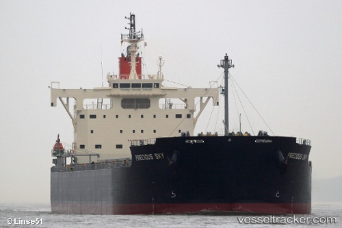
 GLORIOUS SKY
Current Status
Where is the vessel?
GLORIOUS SKY is currently in Near Sete, based on AIS data received about 1h ago.
Latest AIS update:
Current position: 43.40785° N, 3.71968° E (Near Sete)
Average speed (last 7 days): Loading…
Average speed (last 30 days): Loading…
Vessel profile: GLORIOUS SKY is a Bulk Carrier with dimensions 32m x 229m.
This page combines live AIS, route history, probable destination signals, nearby traffic, and port activity for practical vessel monitoring.
The current position of vessel GLORIOUS SKY is 43.40785 lat / 3.71968 lng. Updated: 2026-04-20 07:35:08 UTCNearest reference points:
- Near LA PEYRADE
- Near Palavas-les-Flots
- Near LE CAP D'AGDE
Currently sailing under the flag of Liberia ![]()
GLORIOUS SKY built in 2015 year
Deadweight:
81893 tDetails:
Live Vessel GLORIOUS SKY Analytics (details, animations, etc.)
Recent AIS points (UTC):
2026-04-20 04:38:04 UTC · 43.40784, 3.71966 · SOG 0 kn · COG 55°2026-04-20 05:59:02 UTC · 43.40783, 3.71968 · SOG 0 kn · COG 54°
2026-04-20 07:14:05 UTC · 43.40780, 3.71968 · SOG 0 kn · COG 54°
2026-04-20 07:35:08 UTC · 43.40785, 3.71968 · SOG 0 kn · COG 54°