 vesseltracker.com
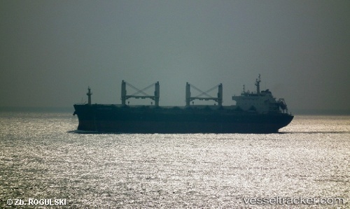
 PROTECTOR ST. RAPHAEL
Current Status
Where is the vessel?
PROTECTOR ST. RAPHAEL is currently in 15 nm W of Labason/Zamboanga, based on AIS data received about 13h ago.
Latest AIS update:
Current position: 8.00771° N, 122.26887° E (15 nm W of Labason/Zamboanga)
Average speed (last 7 days): Loading…
Average speed (last 30 days): Loading…
Vessel profile: PROTECTOR ST. RAPHAEL is a Bulk Carrier with dimensions 32m x 190m.
This page combines live AIS, route history, probable destination signals, nearby traffic, and port activity for practical vessel monitoring.
The current position of vessel PROTECTOR ST. RAPHAEL is 8.00771 lat / 122.26887 lng. Updated: 2026-04-17 16:22:24 UTCNearest reference points:
- 21 nm NW of Zamboanga
- 14 nm SE of Zamboanga
- 17 nm SW of Bacong
Currently sailing under the flag of Liberia ![]()
PROTECTOR ST. RAPHAEL built in 2010 year
Deadweight:
56873 tDetails:
Live Vessel PROTECTOR ST. RAPHAEL Analytics (details, animations, etc.)
Recent AIS points (UTC):
2026-04-17 14:55:26 UTC · 8.00826, 122.26874 · SOG 0.1 kn · COG 87°2026-04-17 16:22:24 UTC · 8.00771, 122.26887 · SOG 0.1 kn · COG 68°
2026-04-17 16:22:24 UTC · 8.00771, 122.26887 · SOG 0.1 kn · COG 68°
2026-04-17 16:22:24 UTC · 8.00771, 122.26887 · SOG 0.1 kn · COG 68°