 vesseltracker.com
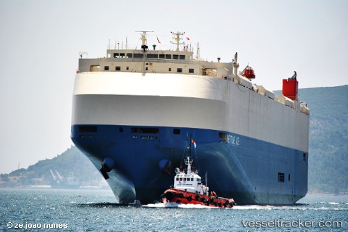
 NEPTUNE ACE
Current Status
Where is the vessel?
NEPTUNE ACE is currently in 36 nm SE of Folly Beach, based on AIS data received less than 1h ago.
Latest AIS update:
Current position: 32.19072° N, 79.46434° W (36 nm SE of Folly Beach)
Average speed (last 7 days): Loading…
Average speed (last 30 days): Loading…
Vessel profile: NEPTUNE ACE is a Vehicles Carrier with dimensions m x m.
This page combines live AIS, route history, probable destination signals, nearby traffic, and port activity for practical vessel monitoring.
The current position of vessel NEPTUNE ACE is 32.19072 lat / -79.46434 lng. Updated: 2026-04-21 01:57:48 UTCNearest reference points:
- 33 nm S of Kiawah Island
- Near Charleston
- Near Saint Andrews
Currently sailing under the flag of Japan ![]()
Details:
Live Vessel NEPTUNE ACE Analytics (details, animations, etc.)
Recent AIS points (UTC):
2026-04-20 20:59:59 UTC · 31.05723, -81.25833 · SOG 12.1 kn · COG 122°2026-04-20 20:59:59 UTC · 31.05723, -81.25833 · SOG 12.1 kn · COG 122°
2026-04-20 23:48:30 UTC · 31.78809, -79.98229 · SOG 17.1 kn · COG 34°
2026-04-21 01:57:48 UTC · 32.19072, -79.46434 · SOG 17 kn · COG 64°