 vesseltracker.com
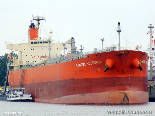
 Kamome Victoria
Current Status
Where is the vessel?
Kamome Victoria is currently in Near Pasadena, based on AIS data received less than 1h ago.
Latest AIS update:
Current position: 29.74633° N, 95.18795° W (Near Pasadena)
Average speed (last 7 days): Loading…
Average speed (last 30 days): Loading…
Vessel profile: Kamome Victoria is a Oil Products Tanker with dimensions 228m x 228m.
This page combines live AIS, route history, probable destination signals, nearby traffic, and port activity for practical vessel monitoring.
The current position of vessel Kamome Victoria is 29.74633 lat / -95.18795 lng. Updated: 2026-04-20 22:15:12 UTCNearest reference points:
- Near Pasadena
- Near Jacinto City
- Near Morgan Point
Currently sailing under the flag of Panama ![]()
Kamome Victoria built in 2011 year
Deadweight:
74908 tDetails:
Live Vessel Kamome Victoria Analytics (details, animations, etc.)
Recent AIS points (UTC):
2026-04-20 19:39:13 UTC · 29.74633, -95.18797 · SOG 0 kn · COG 80°2026-04-20 19:48:10 UTC · 29.74627, -95.18795 · SOG 0 kn · COG 80°
2026-04-20 21:48:10 UTC · 29.74638, -95.18798 · SOG 0 kn · COG 80°
2026-04-20 22:15:12 UTC · 29.74633, -95.18795 · SOG 0 kn · COG 80°