 vesseltracker.com
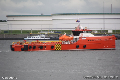
 Esnaad 712
Current Status
Where is the vessel?
Esnaad 712 is currently in 29 nm N of Mubarraz Island, based on AIS data received about 1h ago.
Latest AIS update:
Current position: 24.90229° N, 53.72188° E (29 nm N of Mubarraz Island)
Average speed (last 7 days): Loading…
Average speed (last 30 days): Loading…
Vessel profile: Esnaad 712 is a Offshore Tug Supply Ship with dimensions 50m x 50m.
This page combines live AIS, route history, probable destination signals, nearby traffic, and port activity for practical vessel monitoring.
The current position of vessel Esnaad 712 is 24.90229 lat / 53.72188 lng. Updated: 2026-04-17 17:50:52 UTCNearest reference points:
- Near Das Island
- 11 nm SW of Fateh Terminal
- Near Esnnad
Currently sailing under the flag of UAE ![]()
Esnaad 712 built in 2011 year
Deadweight:
350 tDetails:
Live Vessel Esnaad 712 Analytics (details, animations, etc.)
Recent AIS points (UTC):
2026-04-17 11:23:11 UTC · 24.90316, 53.72194 · SOG 0.7 kn · COG 223°2026-04-17 13:42:12 UTC · 24.90232, 53.72188 · SOG 0 kn · COG -1°
2026-04-17 16:02:53 UTC · 24.90230, 53.72190 · SOG 0 kn · COG 148°
2026-04-17 17:50:52 UTC · 24.90229, 53.72188 · SOG 0 kn · COG 148°