 vesseltracker.com
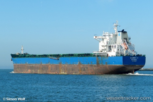
Ulusoy 11
Current StatusWhere is the vessel?
Ulusoy 11 is currently in 19 nm N of Ile D’Ouessant, based on AIS data received less than 1h ago.
Latest AIS update:
Current position: 48.97991° N, 5.58666° W (19 nm N of Ile D’Ouessant)
Average speed (last 7 days): Loading…
Average speed (last 30 days): Loading…
Vessel profile: Ulusoy 11 is a Bulk Carrier with dimensions 36m x 229m.
This page combines live AIS, route history, probable destination signals, nearby traffic, and port activity for practical vessel monitoring.
The current position of vessel Ulusoy 11 is 48.97991 lat / -5.58666 lng. Updated: 2026-03-31 14:16:05 UTCNearest reference points:
- 18 nm NE of Ile D’Ouessant
- 16 nm NW of Ile D’Ouessant
- 34 nm W of Verzy
Details:
Live Vessel Ulusoy 11 Analytics (details, animations, etc.)
Recent AIS points (UTC):
2026-03-31 07:31:44 UTC · 49.54702, -4.11014 · SOG 10.3 kn · COG 237°2026-03-31 09:40:26 UTC · 49.35305, -4.62687 · SOG 11.3 kn · COG 238°
2026-03-31 11:26:37 UTC · 49.18914, -5.04602 · SOG 10 kn · COG 235°
2026-03-31 14:16:05 UTC · 48.97991, -5.58666 · SOG 7.8 kn · COG 230°