 vesseltracker.com
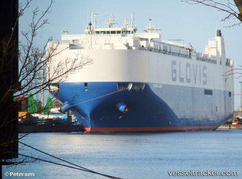
 GLOVIS CHALLENGE
Current Status
Where is the vessel?
GLOVIS CHALLENGE is currently in 96 nm SW of Amio, based on AIS data received about 3h ago.
Latest AIS update:
Current position: 7.40348° S, 149.78566° E (96 nm SW of Amio)
Average speed (last 7 days): Loading…
Average speed (last 30 days): Loading…
Vessel profile: GLOVIS CHALLENGE is a Vehicles Carrier with dimensions 32m x 199m.
This page combines live AIS, route history, probable destination signals, nearby traffic, and port activity for practical vessel monitoring.
The current position of vessel GLOVIS CHALLENGE is -7.40348 lat / 149.78566 lng. Updated: 2026-03-29 00:27:22 UTCNearest reference points:
- 42 nm E of Tami Island
Currently sailing under the flag of Korea (Republic of) ![]()
GLOVIS CHALLENGE built in 2012 year
Deadweight:
20895 tDetails:
Live Vessel GLOVIS CHALLENGE Analytics (details, animations, etc.)
Recent AIS points (UTC):
2026-03-28 19:53:06 UTC · -8.07804, 150.82037 · SOG 16.7 kn · COG 303°2026-03-28 21:29:53 UTC · -7.83147, 150.44511 · SOG 16.3 kn · COG 301°
2026-03-28 23:30:53 UTC · -7.53809, 149.99281 · SOG 15.8 kn · COG 306°
2026-03-29 00:27:22 UTC · -7.40348, 149.78566 · SOG 15.4 kn · COG 308°