 vesseltracker.com
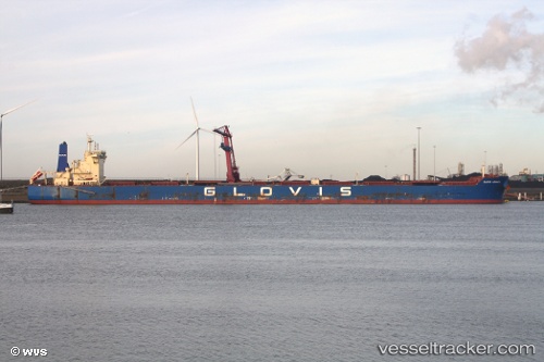
Vessel GLOVIS ADVANCE IMO: 9590606, MMSI: 441222000 Bulk Carrier
UTC, -1.83266, -10.76412, course: 137, speed: 10.4
UTC, -2.13719, -10.50783, course: 138, speed: 10.4
2026-03-24 19:27:41 UTC, -2.35135, -10.33177, course: 138, speed: 10.4
Live Vessel GLOVIS ADVANCE Analytics (details, animations, etc.)
Live AIS position: UTC. Open sea, approx. 413 nm off the nearest listed port), updated 2026-03-24 19:27:41 UTC.Find the position of the vessel GLOVIS ADVANCE on the map. The latter are known coordinates and path.
marine traffic ship tracker show on live map
The current position of vessel GLOVIS ADVANCE is -2.35135 lat / -10.33177 lng. Updated: 2026-03-24 19:27:41 UTCCurrently sailing under the flag of Korea (Republic of)
GLOVIS ADVANCE built in 2012 year
Deadweight:
179217 tDetails:
Last coordinates of the vessel:
UTC, -1.61428, -10.94136, course: 140, speed: 10.4UTC, -1.83266, -10.76412, course: 137, speed: 10.4
UTC, -2.13719, -10.50783, course: 138, speed: 10.4
2026-03-24 19:27:41 UTC, -2.35135, -10.33177, course: 138, speed: 10.4