 vesseltracker.com
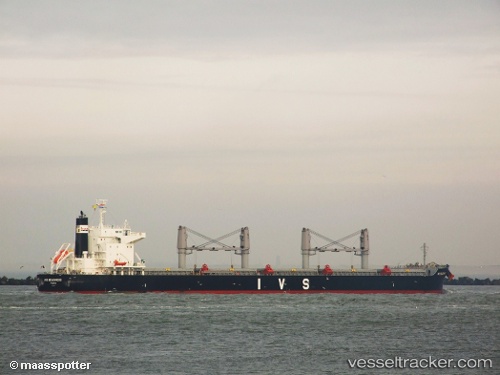
 ANASSA
Current Status
Where is the vessel?
ANASSA is currently in 101 nm S of Tsiombe, based on AIS data received about 10h ago.
Latest AIS update:
Current position: 26.95176° S, 45.09581° E (101 nm S of Tsiombe)
Average speed (last 7 days): Loading…
Average speed (last 30 days): Loading…
Vessel profile: ANASSA is a Bulk Carrier with dimensions 199m x 199m.
This page combines live AIS, route history, probable destination signals, nearby traffic, and port activity for practical vessel monitoring.
The current position of vessel ANASSA is -26.95176 lat / 45.09581 lng. Updated: 2026-04-10 06:56:42 UTCNearest reference points:
- 106 nm S of Tsiombe
- 70 nm SW of Tsiombe
- 148 nm SW of Tsiombe
Currently sailing under the flag of Liberia ![]()
ANASSA built in 2011 year
Deadweight:
61418 tDetails:
Live Vessel ANASSA Analytics (details, animations, etc.)
Recent AIS points (UTC):
2026-04-10 02:31:23 UTC · -26.74390, 46.07905 · SOG 13.1 kn · COG 253°2026-04-10 03:58:04 UTC · -26.81591, 45.74413 · SOG 12.3 kn · COG 253°
2026-04-10 06:10:22 UTC · -26.91768, 45.26482 · SOG 11.9 kn · COG 252°
2026-04-10 06:56:42 UTC · -26.95176, 45.09581 · SOG 12 kn · COG 252°