 vesseltracker.com
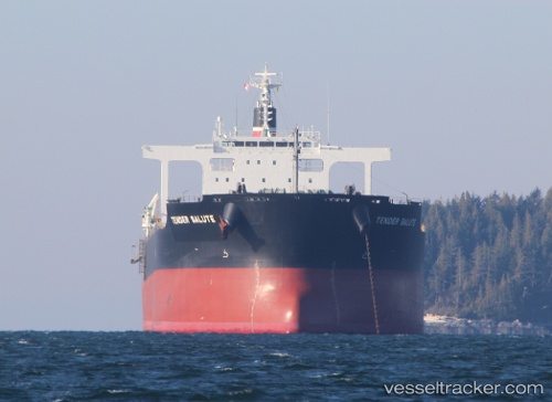
 POWER LOONG
Current Status
Where is the vessel?
POWER LOONG is currently in 78 nm NE of Jingjiang, based on AIS data received about 1h ago.
Latest AIS update:
Current position: 32.13172° N, 123.27874° E (78 nm NE of Jingjiang)
Average speed (last 7 days): Loading…
Average speed (last 30 days): Loading…
Vessel profile: POWER LOONG is a Bulk Carrier with dimensions 38m x 235m.
This page combines live AIS, route history, probable destination signals, nearby traffic, and port activity for practical vessel monitoring.
The current position of vessel POWER LOONG is 32.13172 lat / 123.27874 lng. Updated: 2026-04-01 14:20:06 UTCNearest reference points:
- 77 nm NE of Jingjiang
- 70 nm NE of Jingjiang
- 52 nm E of Lusi
Currently sailing under the flag of Panama ![]()
POWER LOONG built in 2011 year
Deadweight:
95695 tDetails:
Live Vessel POWER LOONG Analytics (details, animations, etc.)
Recent AIS points (UTC):
2026-04-01 10:14:42 UTC · 31.31364, 123.31881 · SOG 10.7 kn · COG 356°2026-04-01 11:44:02 UTC · 31.59466, 123.28468 · SOG 11 kn · COG 5°
2026-04-01 13:51:31 UTC · 32.02729, 123.28317 · SOG 12.7 kn · COG 3°
2026-04-01 14:20:06 UTC · 32.13172, 123.27874 · SOG 13 kn · COG 3°