 vesseltracker.com
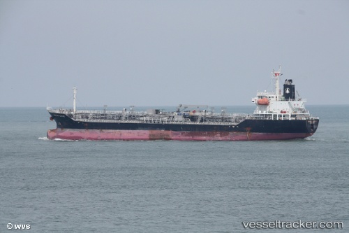
 TRANS TIND
Current Status
Where is the vessel?
TRANS TIND is currently in 23 nm E of Sant Jaume d'Enveja, based on AIS data received less than 1h ago.
Latest AIS update:
Current position: 40.58893° N, 1.20534° E (23 nm E of Sant Jaume d'Enveja)
Average speed (last 7 days): Loading…
Average speed (last 30 days): Loading…
Vessel profile: TRANS TIND is a Oil/Chemical Tanker with dimensions m x m.
This page combines live AIS, route history, probable destination signals, nearby traffic, and port activity for practical vessel monitoring.
The current position of vessel TRANS TIND is 40.58893 lat / 1.20534 lng. Updated: 2026-03-30 21:58:02 UTCNearest reference points:
- 24 nm SW of Sampedor
- 16 nm SW of Sampedor
- Near Salou
Currently sailing under the flag of Bahamas ![]()
Details:
Live Vessel TRANS TIND Analytics (details, animations, etc.)
Recent AIS points (UTC):
2026-03-30 15:29:05 UTC · 41.09847, 1.22659 · SOG 0 kn · COG 229°2026-03-30 18:05:09 UTC · 41.09846, 1.22656 · SOG 0 kn · COG 229°
2026-03-30 20:02:48 UTC · 41.02844, 1.20796 · SOG 14 kn · COG 169°
2026-03-30 21:58:02 UTC · 40.58893, 1.20534 · SOG 13.7 kn · COG 193°