 vesseltracker.com
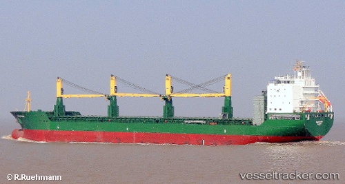
 AAL PARIS
Current Status
Where is the vessel?
AAL PARIS is currently in 36 nm W of Guernsey, based on AIS data received about 2h ago.
Latest AIS update:
Current position: 49.58665° N, 3.48226° W (36 nm W of Guernsey)
Average speed (last 7 days): Loading…
Average speed (last 30 days): Loading…
Vessel profile: AAL PARIS is a General Cargo Ship with dimensions 179m x 28m.
This page combines live AIS, route history, probable destination signals, nearby traffic, and port activity for practical vessel monitoring.
The current position of vessel AAL PARIS is 49.58665 lat / -3.48226 lng. Updated: 2026-04-02 20:02:10 UTCNearest reference points:
- 27 nm N of Verzy
- 23 nm NW of Saint Sampson
- Near Verzy
Currently sailing under the flag of Cyprus ![]()
AAL PARIS built in 2011 year
Deadweight:
33287 tDetails:
Live Vessel AAL PARIS Analytics (details, animations, etc.)
Recent AIS points (UTC):
2026-04-02 13:28:16 UTC · 48.74259, -5.61411 · SOG 13.8 kn · COG 31°2026-04-02 16:10:44 UTC · 49.09196, -4.76037 · SOG 15.4 kn · COG 61°
2026-04-02 18:21:21 UTC · 49.37501, -4.02734 · SOG 15.3 kn · COG 57°
2026-04-02 20:02:10 UTC · 49.58665, -3.48226 · SOG 14.4 kn · COG 60°