 vesseltracker.com
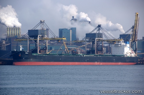
 Bali
Bali
Current Status
Where is the vessel?
Bali is currently in 16 nm E of CORON, based on AIS data received about 1h ago.
Latest AIS update:
Current position: 11.96667° N, 120.48333° E (16 nm E of CORON)
Average speed (last 7 days): Loading…
Average speed (last 30 days): Loading…
Vessel profile: Bali is a Bulk Carrier with dimensions 229m x 32m.
This page combines live AIS, route history, probable destination signals, nearby traffic, and port activity for practical vessel monitoring.
The current position of vessel Bali is 11.96667 lat / 120.48333 lng. Updated: 2026-04-20 02:27:48 UTCNearest reference points:
- 19 nm NE of CORON
- 12 nm S of Lobo
- Near Lobo
Currently sailing under the flag of Malta ![]()
Bali built in 2012 year
Deadweight:
81353 tDetails:
Live Vessel Bali Analytics (details, animations, etc.)
Recent AIS points (UTC):
2026-04-19 22:12:48 UTC · 12.56667, 120.10667 · SOG 11 kn · COG -1°2026-04-20 00:06:49 UTC · 12.41333, 120.44667 · SOG 11 kn · COG -1°
2026-04-20 02:03:47 UTC · 12.04167, 120.47667 · SOG 11 kn · COG -1°
2026-04-20 02:27:48 UTC · 11.96667, 120.48333 · SOG 11 kn · COG -1°