 vesseltracker.com
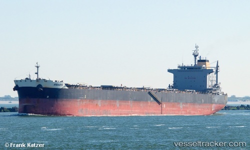
 TROMBETAS
Current Status
Where is the vessel?
TROMBETAS is currently in 12 nm S of DAUPHIN ISLAND, based on AIS data received about 4h ago.
Latest AIS update:
Current position: 30.04887° N, 88.08769° W (12 nm S of DAUPHIN ISLAND)
Average speed (last 7 days): Loading…
Average speed (last 30 days): Loading…
Vessel profile: TROMBETAS is a Bulk Carrier with dimensions 32m x 229m.
This page combines live AIS, route history, probable destination signals, nearby traffic, and port activity for practical vessel monitoring.
The current position of vessel TROMBETAS is 30.04887 lat / -88.08769 lng. Updated: 2026-04-08 23:42:27 UTCNearest reference points:
- Near BAYOU LA BATRE
- Near Point Clear
- Near Bon Secour
Currently sailing under the flag of Liberia ![]()
TROMBETAS built in 2012 year
Deadweight:
81615 tDetails:
Live Vessel TROMBETAS Analytics (details, animations, etc.)
Recent AIS points (UTC):
2026-04-08 14:14:41 UTC · 30.04922, -88.08732 · SOG 0.8 kn · COG -1°2026-04-08 14:14:41 UTC · 30.04922, -88.08732 · SOG 0.8 kn · COG -1°
2026-04-08 23:42:27 UTC · 30.04887, -88.08769 · SOG 0.2 kn · COG 95°
2026-04-08 23:42:27 UTC · 30.04887, -88.08769 · SOG 0.2 kn · COG 95°