 vesseltracker.com
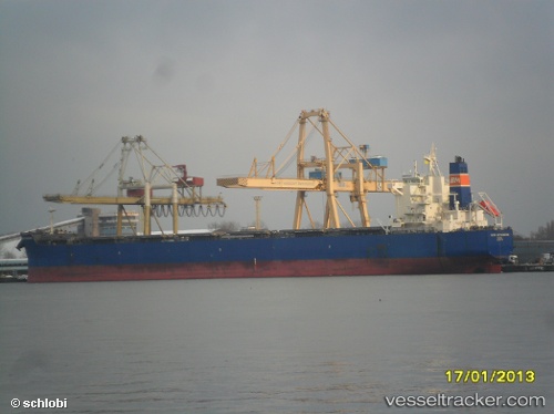
Tinos
Current StatusWhere is the vessel?
Tinos is currently in 11 nm N of Outeiro, based on AIS data received less than 1h ago.
Latest AIS update:
Current position: 1.07230° S, 48.46992° W (11 nm N of Outeiro)
Average speed (last 7 days): Loading…
Average speed (last 30 days): Loading…
Vessel profile: Tinos is a Bulk Carrier with dimensions 32m x 229m.
This page combines live AIS, route history, probable destination signals, nearby traffic, and port activity for practical vessel monitoring.
The current position of vessel Tinos is -1.07230 lat / -48.46992 lng. Updated: 2026-04-14 06:18:28 UTCNearest reference points:
- Near Belem
- 70 nm N of Tucuma
- 55 nm N of Tucuma
Details:
Live Vessel Tinos Analytics (details, animations, etc.)
Recent AIS points (UTC):
2026-04-13 23:24:29 UTC · -1.07565, -48.47318 · SOG 0 kn · COG 54°2026-04-14 01:27:28 UTC · -1.07412, -48.47340 · SOG 0.2 kn · COG 93°
2026-04-14 04:12:29 UTC · -1.07227, -48.47008 · SOG 0 kn · COG 207°
2026-04-14 06:18:28 UTC · -1.07230, -48.46992 · SOG 0 kn · COG 217°