 vesseltracker.com
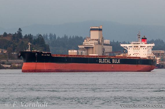
Gl La Paz
Current StatusWhere is the vessel?
Gl La Paz is currently in 15 nm E of Boyne Island, based on AIS data received less than 1h ago.
Latest AIS update:
Current position: 23.86397° S, 151.60751° E (15 nm E of Boyne Island)
Average speed (last 7 days): Loading…
Average speed (last 30 days): Loading…
Vessel profile: Gl La Paz is a Bulk Carrier with dimensions 38m x 240m.
This page combines live AIS, route history, probable destination signals, nearby traffic, and port activity for practical vessel monitoring.
The current position of vessel Gl La Paz is -23.86397 lat / 151.60751 lng. Updated: 2026-04-21 04:23:55 UTCNearest reference points:
- Near Boyne Island
- Near Gladstone Harbor
- Near ROSSLYN
Details:
Live Vessel Gl La Paz Analytics (details, animations, etc.)
Recent AIS points (UTC):
2026-04-21 01:06:01 UTC · -23.86331, 151.60805 · SOG 0.3 kn · COG 116°2026-04-21 01:59:57 UTC · -23.86275, 151.60814 · SOG 0.1 kn · COG 142°
2026-04-21 04:15:09 UTC · -23.86349, 151.60793 · SOG 0.1 kn · COG 138°
2026-04-21 04:23:55 UTC · -23.86397, 151.60751 · SOG 0.1 kn · COG 119°