 vesseltracker.com
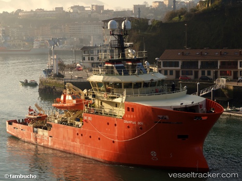
Grampian Don
Current StatusWhere is the vessel?
Grampian Don is currently in 27 nm SE of Alba Oil Field, based on AIS data received about 1d ago.
Latest AIS update:
Current position: 57.85773° N, 1.83492° E (27 nm SE of Alba Oil Field)
Average speed (last 7 days): Loading…
Average speed (last 30 days): Loading…
Vessel profile: Grampian Don is a Standby Safety Vessel with dimensions 14m x 50m.
This page combines live AIS, route history, probable destination signals, nearby traffic, and port activity for practical vessel monitoring.
The current position of vessel Grampian Don is 57.85773 lat / 1.83492 lng. Updated: 2026-04-03 23:38:46 UTCNearest reference points:
- Near Alba Oil Field
- 19 nm W of Curlew
- 10 nm N of Leadon
Details:
Live Vessel Grampian Don Analytics (details, animations, etc.)
Recent AIS points (UTC):
2026-04-03 03:47:16 UTC · 57.89911, 1.81143 · SOG 1.6 kn · COG 170°2026-04-03 23:38:46 UTC · 57.85773, 1.83492 · SOG 3.8 kn · COG 50°
2026-04-03 23:38:46 UTC · 57.85773, 1.83492 · SOG 3.8 kn · COG 50°
2026-04-03 23:38:46 UTC · 57.85773, 1.83492 · SOG 3.8 kn · COG 50°