 vesseltracker.com
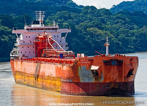
 Csl Tarantau
Current Status
Where is the vessel?
Csl Tarantau is currently in 24 nm S of Ben Slimane, based on AIS data received about 2h ago.
Latest AIS update:
Current position: 33.20500° N, 71.29333° W (24 nm S of Ben Slimane)
Average speed (last 7 days): Loading…
Average speed (last 30 days): Loading…
Vessel profile: Csl Tarantau is a Self Discharging Bulk Carrier with dimensions 220m x 220m.
This page combines live AIS, route history, probable destination signals, nearby traffic, and port activity for practical vessel monitoring.
The current position of vessel Csl Tarantau is 33.20500 lat / -71.29333 lng. Updated: 2026-04-06 04:13:22 UTCNearest reference points:
- 150 nm S of Ben Slimane
- 91 nm E of Rodanthe
Currently sailing under the flag of Bahamas ![]()
Csl Tarantau built in 2013 year
Deadweight:
71500 tDetails:
Live Vessel Csl Tarantau Analytics (details, animations, etc.)
Recent AIS points (UTC):
2026-04-05 22:07:24 UTC · 32.19500, -72.37167 · SOG 13 kn · COG -1°2026-04-06 00:04:24 UTC · 32.51833, -72.03333 · SOG 13 kn · COG -1°
2026-04-06 01:49:24 UTC · 32.79833, -71.72333 · SOG 13 kn · COG -1°
2026-04-06 04:13:22 UTC · 33.20500, -71.29333 · SOG 13 kn · COG -1°