 vesseltracker.com
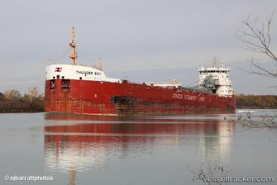
 Thunder Bay
Current Status
Where is the vessel?
Thunder Bay is currently in Near SAULT STE MARIE, based on AIS data received about 8h ago.
Latest AIS update:
Current position: 46.40328° N, 84.24108° W (Near SAULT STE MARIE)
Average speed (last 7 days): Loading…
Average speed (last 30 days): Loading…
Vessel profile: Thunder Bay is a Self Discharging Bulk Carrier with dimensions 225m x 24m.
This page combines live AIS, route history, probable destination signals, nearby traffic, and port activity for practical vessel monitoring.
The current position of vessel Thunder Bay is 46.40328 lat / -84.24108 lng. Updated: 2026-04-10 07:46:41 UTCNearest reference points:
- Near Mackinaw City
- Near Meldrum
Currently sailing under the flag of Canada ![]()
Thunder Bay built in 2013 year
Deadweight:
34433 tDetails:
Live Vessel Thunder Bay Analytics (details, animations, etc.)
Recent AIS points (UTC):
2026-04-10 02:20:12 UTC · 46.40328, -84.24107 · SOG 0 kn · COG 289°2026-04-10 04:16:42 UTC · 46.40328, -84.24107 · SOG 0 kn · COG 289°
2026-04-10 06:25:42 UTC · 46.40328, -84.24107 · SOG 0 kn · COG 289°
2026-04-10 07:46:41 UTC · 46.40328, -84.24108 · SOG 0 kn · COG 289°