 vesseltracker.com
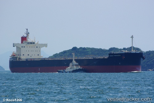
Energy Primavera
Current StatusWhere is the vessel?
Energy Primavera is currently in 221 nm SW of Santa Rosa Island, based on AIS data received less than 1h ago.
Latest AIS update:
Current position: 31.54578° N, 123.41547° W (221 nm SW of Santa Rosa Island)
Average speed (last 7 days): Loading…
Average speed (last 30 days): Loading…
Vessel profile: Energy Primavera is a Bulk Carrier with dimensions 32m x 229m.
This page combines live AIS, route history, probable destination signals, nearby traffic, and port activity for practical vessel monitoring.
The current position of vessel Energy Primavera is 31.54578 lat / -123.41547 lng. Updated: 2026-04-18 07:38:51 UTCNearest reference points:
- Open sea, approx. 413 nm off the nearest listed port
Details:
Live Vessel Energy Primavera Analytics (details, animations, etc.)
Recent AIS points (UTC):
2026-04-18 02:01:52 UTC · 32.43423, -124.13615 · SOG 11.9 kn · COG 145°2026-04-18 03:48:23 UTC · 32.15114, -123.90522 · SOG 11.6 kn · COG 144°
2026-04-18 06:02:51 UTC · 31.79900, -123.62034 · SOG 11.4 kn · COG 145°
2026-04-18 07:38:51 UTC · 31.54578, -123.41547 · SOG 11.6 kn · COG 144°