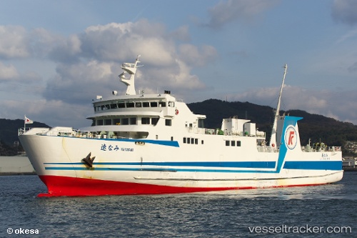
Hayanami
Current StatusWhere is the vessel?
Hayanami is currently in Near Oita, based on AIS data received about 14h ago.
Latest AIS update:
Current position: 33.25913° N, 131.86382° E (Near Oita)
Average speed (last 7 days): Loading…
Average speed (last 30 days): Loading…
Vessel profile: Hayanami is a Passenger Ro Ro Cargo Ship with dimensions 14m x 79m.
This page combines live AIS, route history, probable destination signals, nearby traffic, and port activity for practical vessel monitoring.
The current position of vessel Hayanami is 33.25913 lat / 131.86382 lng. Updated: 2026-05-24 04:32:09 UTCNearest reference points:
- Near Kitsuki
- Near Oita
- 11 nm E of SAEKI
Details:
Live Vessel Hayanami Analytics (details, animations, etc.)
Recent AIS points (UTC):
2026-05-23 20:51:33 UTC · 33.25016, 131.86542 · SOG 0 kn · COG 224°2026-05-23 20:51:33 UTC · 33.25016, 131.86542 · SOG 0 kn · COG 224°
2026-05-24 03:11:29 UTC · 33.38952, 132.11665 · SOG 1.5 kn · COG -1°
2026-05-24 04:32:09 UTC · 33.25913, 131.86382 · SOG 13.5 kn · COG -1°