 vesseltracker.com
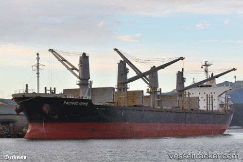
 Pacific Hope
Current Status
Where is the vessel?
Pacific Hope is currently in Near Cape St. Jacques, based on AIS data received less than 1h ago.
Latest AIS update:
Current position: 10.20430° N, 107.04189° E (Near Cape St. Jacques)
Average speed (last 7 days): Loading…
Average speed (last 30 days): Loading…
Vessel profile: Pacific Hope is a Bulk Carrier with dimensions 169m x 169m.
This page combines live AIS, route history, probable destination signals, nearby traffic, and port activity for practical vessel monitoring.
The current position of vessel Pacific Hope is 10.20430 lat / 107.04189 lng. Updated: 2026-04-18 06:06:45 UTCNearest reference points:
- Near Cape St. Jacques
- 11 nm SE of Cape St. Jacques
- Near Cape Saint Jacques
Currently sailing under the flag of Panama ![]()
Pacific Hope built in 2011 year
Deadweight:
28200 tDetails:
Live Vessel Pacific Hope Analytics (details, animations, etc.)
Recent AIS points (UTC):
2026-04-17 23:32:46 UTC · 10.20432, 107.04487 · SOG 0 kn · COG 292°2026-04-18 02:06:45 UTC · 10.20614, 107.04333 · SOG 0.5 kn · COG 187°
2026-04-18 03:30:45 UTC · 10.20480, 107.04183 · SOG 0 kn · COG 96°
2026-04-18 06:06:45 UTC · 10.20430, 107.04189 · SOG 0 kn · COG 76°