 vesseltracker.com
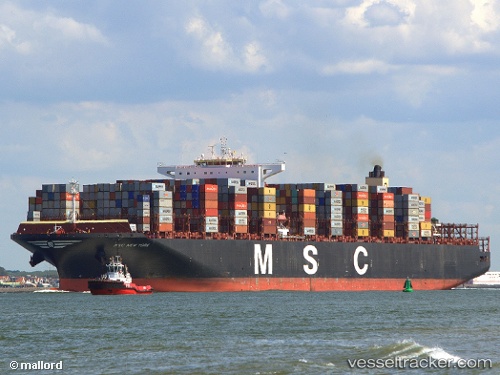
Msc Newyork
Current StatusWhere is the vessel?
Msc Newyork is currently in 49 nm SW of Gageohyangri, based on AIS data received about 1h ago.
Latest AIS update:
Current position: 33.44831° N, 124.43109° E (49 nm SW of Gageohyangri)
Average speed (last 7 days): Loading…
Average speed (last 30 days): Loading…
Vessel profile: Msc Newyork is a Container Ship with dimensions 54m x 399m.
This page combines live AIS, route history, probable destination signals, nearby traffic, and port activity for practical vessel monitoring.
The current position of vessel Msc Newyork is 33.44831 lat / 124.43109 lng. Updated: 2026-04-17 14:58:39 UTCNearest reference points:
- 61 nm S of Gageohyangri
- 47 nm W of Hallim
- 96 nm SW of Hwasun
Details:
Live Vessel Msc Newyork Analytics (details, animations, etc.)
Recent AIS points (UTC):
2026-04-17 09:03:23 UTC · 31.88610, 124.22328 · SOG 16.2 kn · COG -1°2026-04-17 09:03:23 UTC · 31.88610, 124.22328 · SOG 16.2 kn · COG -1°
2026-04-17 09:03:23 UTC · 31.88610, 124.22328 · SOG 16.2 kn · COG -1°
2026-04-17 14:58:39 UTC · 33.44831, 124.43109 · SOG 17.7 kn · COG -1°