 vesseltracker.com
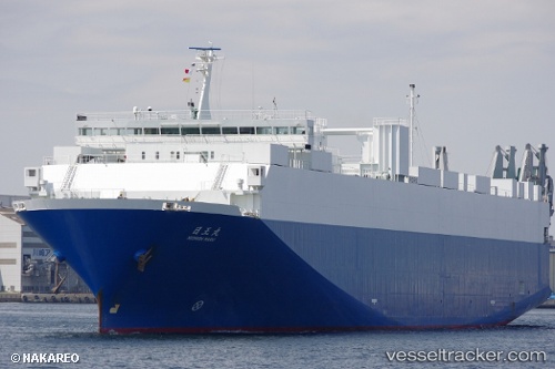
 Nichioh Maru
Current Status
Where is the vessel?
Nichioh Maru is currently in 12 nm E of Iruma, based on AIS data received about 1h ago.
Latest AIS update:
Current position: 34.59969° N, 139.03334° E (12 nm E of Iruma)
Average speed (last 7 days): Loading…
Average speed (last 30 days): Loading…
Vessel profile: Nichioh Maru is a Vehicles Carrier with dimensions 170m x 26m.
This page combines live AIS, route history, probable destination signals, nearby traffic, and port activity for practical vessel monitoring.
The current position of vessel Nichioh Maru is 34.59969 lat / 139.03334 lng. Updated: 2026-04-10 01:52:38 UTCNearest reference points:
- Near Iruma
- 10 nm SE of Iruma
- Near Toshima/Tokyo
Currently sailing under the flag of Japan ![]()
Details:
Live Vessel Nichioh Maru Analytics (details, animations, etc.)
Recent AIS points (UTC):
2026-04-09 19:36:11 UTC · 34.06670, 136.81042 · SOG 18.7 kn · COG 54°2026-04-09 22:19:25 UTC · 34.32057, 137.76730 · SOG 18.1 kn · COG 92°
2026-04-09 23:12:12 UTC · 34.36720, 138.08998 · SOG 19 kn · COG 79°
2026-04-10 01:52:38 UTC · 34.59969, 139.03334 · SOG 16.5 kn · COG 50°